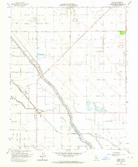
1963 Map of Helm
USGS Topo · Published 1964About this map
Helm sits as a central rail hub in the San Joaquin Valley, where the Southern Pacific tracks run parallel to the irrigation and flood control infrastructure of the Fresno Slough. This landscape is defined by the rigid grid of agricultural avenues and the diagonal cut of the James Bypass, which directs water through the heart of the territory. The northern section of the map reveals the industrial footprint of the Raisin City Oil Field, featuring numerous wells and a network of service roads that contrast with the surrounding fields. Water management is a dominant theme here, with the winding paths of Fish Slough intersecting with the engineered straight lines of the canal system. The presence of a Landing Strip near the railroad line suggests the area's dual reliance on ground and aerial logistics for large-scale ranching and petroleum operations during the early 1960s.
Find a feature on this map
32 named features on this map. Tap any name to fly to it.
Don’t see what you’re looking for? This feature index may not catch every label — zoom into the map to look around manually.
Map Details
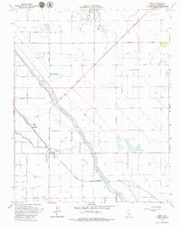
Editions of this 1963 Helm Map
2 editions found
Other maps of this area

1912 · Coalinga
USGS Topo · 1:125,000

1923 · Kearney Park
USGS Topo · 1:31,680

1924 · Jamesan
USGS Topo · 1:31,680

1925 · Helm
USGS Topo · 1:31,680

1925 · San Joaquin
USGS Topo · 1:31,680

1925 · Raisin
USGS Topo · 1:31,680

1927 · Burrel
USGS Topo · 1:31,680

1931 · Wheatville
USGS Topo · 1:31,680

1931 · Towne Oil Station
USGS Topo · 1:31,680
1946 · Kearney Park
USGS Topo · 1:24,000