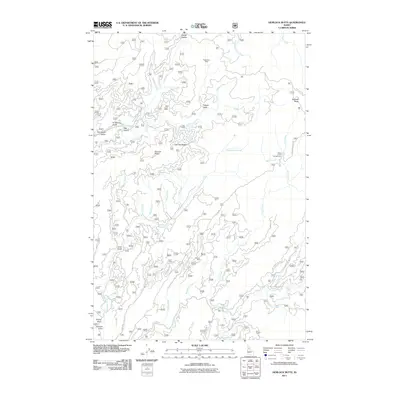
2011 Map of Hemlock Butte
USGS Topo · Published 2011About this map
The Clearwater National Forest region around Hemlock Butte is defined by a dense network of forest development roads and specialized mining history. In the early 21st century, this landscape remains primarily a working forest and recreation area, intersected by Lolo Creek and the long drainages of Musselshell Creek and Orofino Creek. Significant evidence of historical resource extraction is visible through the positioning of the Pistol Grip Mine, Red Cloud Mine, and Pioneer Mine, which are situated along steep gulches and ridges. The map reveals how the terrain dictates movement, with named crossings and high points like French Saddle and Lost Hat Saddle serving as key navigational markers. Recreational use is anchored by the Belle Creek Campground, while names like Dan Lee Ridge and Greer Gulch provide a window into the local nomenclature and family-named landmarks of this Idaho County interior.
Find a feature on this map
44 named features on this map. Tap any name to fly to it.
Don’t see what you’re looking for? This feature index may not catch every label — zoom into the map to look around manually.
Map Details
Editions of this 2011 Hemlock Butte Map
This is the sole edition of this map. No revisions or reprints were ever made.
Other maps of this area

1923 · Washington Creek
USGS Topo · 1:125,000

1924 · Weippe
USGS Topo · 1:125,000

1938 · Headquarters
USGS Topo · 1:48,000

1944 · Headquarters
USGS Topo · 1:62,500

1956 · Hamilton
USGS Topo · 1:250,000

1959 · Hamilton
USGS Topo · 1:250,000

1960 · Hamilton
USGS Topo · 1:250,000

1964 · Hamilton
USGS Topo · 1:250,000
1965 · Larch Butte
USGS Topo · 1:24,000

1965 · French Mountain
USGS Topo · 1:24,000