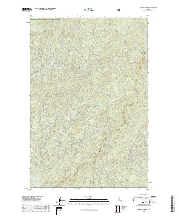
2024 Map of Hemlock Butte
USGS Topo · Published 2024About this map
Clearwater National Forest dominates this landscape along the boundary of Clearwater and Idaho counties, where a complex network of ridges and watercourses defines the interior of the Clearwater basin. Notable elevations such as Hemlock Butte and the southern Austin Ridge serve as primary landmarks for navigating the high ground, while Lost Hat Saddle provides a natural pass through the central terrain. The drainage patterns are intricate, with Orofino Creek and Lolo Creek acting as the primary arteries for a multitude of smaller tributaries including Gezel Creek, Rescue Creek, and Musselshell Creek. Evidence of forestry management and mountain access is visible through the system of Forest Service roads, including French Mountain Rd and Nat For Dev Rd 1845, which link the high ridges and provide access to the deep gulches like Armstrong Gulch and Clearwater Gulch.
Find a feature on this map
47 named features on this map. Tap any name to fly to it.
Don’t see what you’re looking for? This feature index may not catch every label — zoom into the map to look around manually.
Map Details
Editions of this 2024 Hemlock Butte Map
This is the sole edition of this map. No revisions or reprints were ever made.
Other maps of this area

1923 · Washington Creek
USGS Topo · 1:125,000

1924 · Weippe
USGS Topo · 1:125,000

1938 · Headquarters
USGS Topo · 1:48,000

1944 · Headquarters
USGS Topo · 1:62,500

1956 · Hamilton
USGS Topo · 1:250,000

1959 · Hamilton
USGS Topo · 1:250,000

1960 · Hamilton
USGS Topo · 1:250,000

1964 · Hamilton
USGS Topo · 1:250,000
1965 · Larch Butte
USGS Topo · 1:24,000

1965 · French Mountain
USGS Topo · 1:24,000