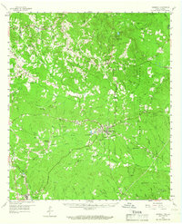
1958 Map of Hemphill
USGS Topo · Published 1966About this map
The Sabine National Forest dominates this East Texas landscape, where the historic El Camino Real cuts through the timbered hills of Sabine County. Centered on the town of Hemphill, the map documents a region deeply tied to the lumber industry and early Texas history, evidenced by the Austin College Forestry Camp and various fire towers like the Chambers Hill Lookout. The settlement patterns here follow the creeks and old timber routes, with small communities such as East Mayfield and Pineland serving as local hubs.
Find a feature on this map
90 named features on this map. Tap any name to fly to it.
Don’t see what you’re looking for? This feature index may not catch every label — zoom into the map to look around manually.
Map Details
Editions of this 1958 Hemphill Map
4 editions found

Other maps of this area

1941 · Zwolle
USGS Topo · 1:62,500

1944 · Negreet
USGS Topo · 1:62,500

1944 · Wiergate
USGS Topo · 1:62,500

1944 · Patroon
USGS Topo · 1:62,500

1944 · Zwolle
USGS Topo · 1:62,500

1948 · Wiergate
USGS Topo · 1:62,500

1953 · Alexandria
USGS Topo · 1:250,000

1953 · Palestine
USGS Topo · 1:250,000

1954 · Columbus
USGS Topo · 1:24,000

1954 · Fairdale
USGS Topo · 1:24,000