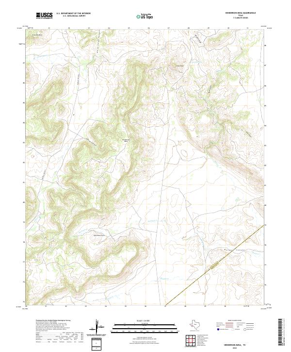
2022 Map of Henderson Mesa
USGS Topo · Published 2022About this map
Henderson Mesa and Polks Peak dominate this landscape in the high desert country of West Texas, where the terrain is defined by a series of significant mesas and canyons. The geography is marked by drainage systems like Horse Thief Cr and Black Cr, which carve through features such as Horse Thief Canyon and Black Canyon. The presence of the Jeff Davis Co Brewster Co boundary line cutting across the southern portion of the quadrangle indicates the political divisions within this sparsely populated ranching region. Cattle ranching history is implied by the naming of Antelope Tank, while local transportation is limited to the winding path of Kokernot Creek Rd, which follows the natural contours of the land through the western flats. From Dutchman Cove to Musquiz Canyon, the map illustrates a network of seasonal watercourses and landforms that have long dictated movement and settlement patterns in this part of the Trans-Pecos.
Find a feature on this map
18 named features on this map. Tap any name to fly to it.
Don’t see what you’re looking for? This feature index may not catch every label — zoom into the map to look around manually.
Map Details
Editions of this 2022 Henderson Mesa Map
This is the sole edition of this map. No revisions or reprints were ever made.
Other maps of this area

1894 · Fort Davis
USGS Topo · 1:125,000

1895 · Alpine
USGS Topo · 1:125,000

1897 · Fort Davis
USGS Topo · 1:125,000

1954 · Fort Stockton
USGS Topo · 1:250,000

1958 · Fort Stockton
USGS Topo · 1:250,000

1972 · Swayback Mountain
USGS Topo · 1:24,000
1972 · Fort Davis SE
USGS Topo · 1:24,000

1972 · Alpine North
USGS Topo · 1:24,000

1972 · Mitre Peak
USGS Topo · 1:24,000

1972 · Elam Mountain
USGS Topo · 1:24,000