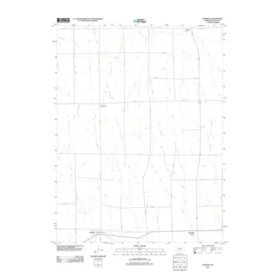
2011 Map of Hendley
USGS Topo · Published 2011About this map
Beaver Creek flows through the southern portion of Furnas County, shaping the settlement patterns of this agrarian landscape. The village of Hendley is the primary hub here, centered on a traditional grid that includes the Hendley Post Office. To the east, Deerfield Corner serves as a local landmark along the road network. The map reveals the rural distribution of community sites, notably Garfield Cemetery in the northeast and Pleasantview Cemetery positioned centrally, reflecting the deep-rooted local history of the surrounding township. This 2011 survey documents a highly organized section-line road system, where routes like Road 711 and Road 421 connect isolated farmsteads across the drainage of Crum Creek.
Find a feature on this map
24 named features on this map. Tap any name to fly to it.
Don’t see what you’re looking for? This feature index may not catch every label — zoom into the map to look around manually.
Map Details
Editions of this 2011 Hendley Map
This is the sole edition of this map. No revisions or reprints were ever made.
Other maps of this area

1896 · Arapahoe
USGS Topo · 1:125,000

1898 · Arapahoe
USGS Topo · 1:125,000

1954 · McCook
USGS Topo · 1:250,000

1955 · Grand Island
USGS Topo · 1:250,000

1957 · McCook
USGS Topo · 1:250,000

1957 · Grand Island
USGS Topo · 1:250,000
1957 · Beaver City SW
USGS Topo · 1:24,000
1957 · Wilsonville
USGS Topo · 1:24,000

1957 · Beaver City SE
USGS Topo · 1:24,000

1958 · McCook
USGS Topo · 1:250,000