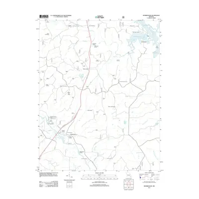
2011 Map of Hendrickson
USGS Topo · Published 2011About this map
The Black River and the northern reaches of Lake Wappapello define this corner of Butler and Wayne Counties, where river-crossing traditions persist alongside modern recreation. Near the settlement of Hendrickson, the map preserves the locations of Kechers Ferry and Magill Ferry, highlighting a time when river transport was essential to local movement. The terrain is deeply incised by numerous hollows, including Stillhouse Hollow, Pink Root Hollow, and Magill Hollow, which share the landscape with several family and community burial grounds such as Military Crossing Cemetery and Davidson Cemetery.
Find a feature on this map
63 named features on this map. Tap any name to fly to it.
Don’t see what you’re looking for? This feature index may not catch every label — zoom into the map to look around manually.
Map Details
Editions of this 2011 Hendrickson Map
This is the sole edition of this map. No revisions or reprints were ever made.
Other maps of this area

1932 · Piedmont
USGS Topo · 1:62,500

1934 · Greenville
USGS Topo · 1:62,500

1934 · Williamsville
USGS Topo · 1:48,000

1935 · Poplar Bluff
USGS Topo · 1:62,500

1935 · Piedmont
USGS Topo · 1:62,500

1939 · Greenville
USGS Topo · 1:62,500

1939 · Poplar Bluff
USGS Topo · 1:62,500

1940 · Williamsville
USGS Topo · 1:62,500

1949 · Rolla
USGS Topo · 1:250,000

1949 · Poplar Bluff
USGS Topo · 1:62,500