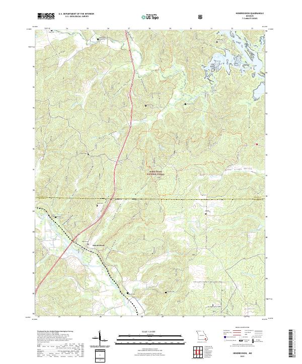
2021 Map of Hendrickson
USGS Topo · Published 2021About this map
The Black River flows through the southwestern corner of this survey, grounding the small settlement of Hendrickson near the Wayne and Butler County line. The landscape is dominated by the dense woodlands of the Mark Twain National Forest, characterized by numerous named hollows such as Hockinberry Hollow, Goldbeck Hollow, and Pink Root Hollow. A significant concentration of family cemeteries including Sloan Cem, Bethel Cem, and Rucker Cem suggests a deep history of rural homesteads throughout the ridges.
Find a feature on this map
58 named features on this map. Tap any name to fly to it.
Don’t see what you’re looking for? This feature index may not catch every label — zoom into the map to look around manually.
Map Details
Editions of this 2021 Hendrickson Map
This is the sole edition of this map. No revisions or reprints were ever made.
Other maps of this area

1932 · Piedmont
USGS Topo · 1:62,500

1934 · Greenville
USGS Topo · 1:62,500

1934 · Williamsville
USGS Topo · 1:48,000

1935 · Poplar Bluff
USGS Topo · 1:62,500

1935 · Piedmont
USGS Topo · 1:62,500

1939 · Greenville
USGS Topo · 1:62,500

1939 · Poplar Bluff
USGS Topo · 1:62,500

1940 · Williamsville
USGS Topo · 1:62,500

1949 · Rolla
USGS Topo · 1:250,000

1949 · Poplar Bluff
USGS Topo · 1:62,500