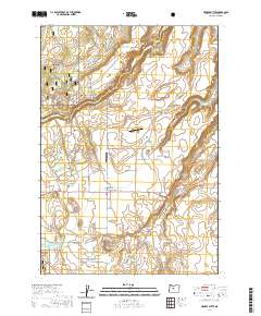
2020 Map of Henkle Butte
USGS Topo · Published 2020About this map
Cloverdale serves as a central point in this high-desert landscape where irrigation and agriculture meet the eastern edge of the Deschutes National Forest. The presence of the Cloverdale Ditch and several water storage points, such as Cyrus Reservoir and Watson Reservoir, underscores the critical role of water management in this arid region. The terrain is defined by prominent volcanic features like Henkle Butte and Fryrear Butte, as well as the deep incisions of McKenzie Canyon and Whychus Creek. Small-scale aviation is represented by Pineridge Ranch Airport and Whippet Field, while a network of rural roads such as Camp Polk Rd and Holmes Rd connects local ranching and residential properties. The transition from the canyon rims to the flatlands near Dry Canyon illustrates the complex geology characteristic of Central Oregon's volcanic plateau.
Find a feature on this map
65 named features on this map. Tap any name to fly to it.
Don’t see what you’re looking for? This feature index may not catch every label — zoom into the map to look around manually.
Map Details
Editions of this 2020 Henkle Butte Map
This is the sole edition of this map. No revisions or reprints were ever made.
Other maps of this area

1926 · Bend
USGS Topo · 1:125,000

1929 · Bend
USGS Topo · 1:125,000

1929 · Three Sisters
USGS Topo · 1:125,000

1932 · Three Sisters
USGS Topo · 1:125,000

1955 · Bend
USGS Topo · 1:250,000

1957 · Bend
USGS Topo · 1:250,000

1958 · Bend
USGS Topo · 1:250,000

1959 · Broken Top
USGS Topo · 1:62,500

1959 · Sisters
USGS Topo · 1:62,500
1962 · Cline Falls
USGS Topo · 1:24,000