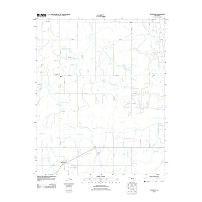
2012 Map of Hennepin
USGS Topo · Published 2012About this map
Hennepin and Katie anchor this Southern Oklahoma landscape, where the agricultural and hydrological patterns of Garvin County are clearly defined. The terrain is structured by a network of drainage systems, most notably Wildhorse Cr and its tributaries including Rock Cr, Eightmile Cr, and Fivemile Cr. These waterways are punctuated by flood control and water management features like the Wildhorse Creek Site 117 Reservoir and Wildhorse Creek Site 56 Reservoir. For those researching local family history, the map identifies key burial sites such as Katie Cem and Fivemile Creek Cem, which serve as permanent markers of the area's rural settlement. The northern edge of the map includes the community of Brady, showing a sparse residential pattern connected by a strict grid of section line roads like Baseline Rd and Old Hwy 29.
Find a feature on this map
38 named features on this map. Tap any name to fly to it.
Don’t see what you’re looking for? This feature index may not catch every label — zoom into the map to look around manually.
Map Details
Editions of this 2012 Hennepin Map
This is the sole edition of this map. No revisions or reprints were ever made.
Other maps of this area

1898 · Pauls Valley
USGS Topo · 1:125,000

1901 · Ardmore
USGS Topo · 1:125,000

1902 · Pauls Valley
USGS Topo · 1:125,000

1918 · Ardmore
USGS Topo · 1:125,000

1957 · Ardmore
USGS Topo · 1:250,000

1963 · Ardmore
USGS Topo · 1:250,000

1964 · Turner Falls
USGS Topo · 1:24,000

1965 · Pauls Valley
USGS Topo · 1:24,000

1965 · Joy
USGS Topo · 1:24,000

1968 · Fox NE
USGS Topo · 1:24,000