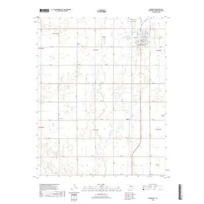
2018 Map of Hennessey
USGS Topo · Published 2018About this map
Hennessey serves as the central hub of this northern Kingfisher County landscape, where the grid-like organization of the Oklahoma prairie is evident through a dense network of section-line roads like E0630 Rd and N2830 Rd. The town's historical depth is marked by several burial grounds, including Hennessey Cem and Calvary Cem to the north, and Maple Grove Cem to the west. Farther south, the small settlement of Jacks and the isolated Evans and Burns Cem indicate the enduring footprint of rural family lineages. The terrain is defined by the winding paths of Turkey Creek and Little Turkey Cr, which cut across the structured agricultural blocks. Aviation's role in the local economy is highlighted by the presence of Enix Boys Airport and Haymaker Airport, reflecting the region's reliance on both land and air for connectivity and commerce in the late 2010s.
Find a feature on this map
59 named features on this map. Tap any name to fly to it.
Don’t see what you’re looking for? This feature index may not catch every label — zoom into the map to look around manually.
Map Details
Editions of this 2018 Hennessey Map
This is the sole edition of this map. No revisions or reprints were ever made.
Other maps of this area

1892 · Kingfisher
USGS Topo · 1:125,000

1893 · Hennessey
USGS Topo · 1:62,500

1893 · Loyal
USGS Topo · 1:62,500

1893 · Ames
USGS Topo · 1:62,500

1895 · Kingfisher
USGS Topo · 1:125,000

1954 · Oklahoma City
USGS Topo · 1:250,000

1955 · Clinton
USGS Topo · 1:250,000

1955 · Enid
USGS Topo · 1:250,000

1955 · Woodward
USGS Topo · 1:250,000

1956 · Ames
USGS Topo · 1:62,500