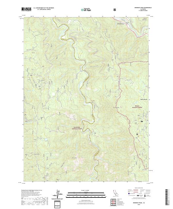
2022 Map of Hennessy Peak
USGS Topo · Published 2022About this map
The South Fork Trinity River carves a deep path through the northern California landscape, forming the boundary between Trinity National Forest and Six Rivers National Forest. This section of the waterway, designated as the Trinity Wild and Scenic River, is flanked by prominent topographical features like Hogback Ridge and Hennessy Ridge. The settlement of Hawkins Bar occupies a northern bend in the river, while Burnt Ranch sits to the east, connected by a network of forest routes including Denny Road. High-elevation points like Hennessy Peak, Gainor Peak, and Sugarloaf Mtn offer significant landmarks for backcountry navigation. The map also records smaller water bodies such as Big Lake and Sucker Lake, along with numerous drainage systems like Mingo Cr and Ammon Cr that feed into the main river corridor.
Find a feature on this map
54 named features on this map. Tap any name to fly to it.
Don’t see what you’re looking for? This feature index may not catch every label — zoom into the map to look around manually.
Map Details
Editions of this 2022 Hennessy Peak Map
This is the sole edition of this map. No revisions or reprints were ever made.
Other maps of this area

1909 · Big Bar
USGS Topo · 1:96,000

1914 · Pilot Creek
USGS Topo · 1:62,500

1915 · Big Bar and Vicinity
USGS Topo · 1:250,000

1922 · China Flat
USGS Topo · 1:62,500

1951 · Pilot Creek
USGS Topo · 1:62,500

1951 · Hyampom
USGS Topo · 1:62,500

1951 · Ironside Mountain
USGS Topo · 1:62,500

1952 · Willow Creek
USGS Topo · 1:62,500

1958 · Redding
USGS Topo · 1:250,000
1977 · Board Camp Mtn
USGS Topo · 1:24,000