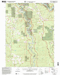
1997 Map of Hennessy Peak
USGS Topo · Published 2001About this map
The South Fork Trinity River flows northward through this 1997 revision, meeting the Trinity River near the border of Six Rivers National Forest and the Klamath National Forest. The landscape is dominated by steep elevations such as Hennessy Peak and Sugarloaf Mountain, with the Hennessy Ridge running north to south. Human impact is centered around forestry and recreation, evidenced by the Lower Trinity Ranger District and Hawkins Bar Recreation Site.
Find a feature on this map
70 named features on this map. Tap any name to fly to it.
Don’t see what you’re looking for? This feature index may not catch every label — zoom into the map to look around manually.
Map Details
Editions of this 1997 Hennessy Peak Map
This is the sole edition of this map. No revisions or reprints were ever made.
Other maps of this area

1909 · Big Bar
USGS Topo · 1:96,000

1914 · Pilot Creek
USGS Topo · 1:62,500

1915 · Big Bar and Vicinity
USGS Topo · 1:250,000

1922 · China Flat
USGS Topo · 1:62,500

1951 · Pilot Creek
USGS Topo · 1:62,500

1951 · Hyampom
USGS Topo · 1:62,500

1951 · Ironside Mountain
USGS Topo · 1:62,500

1952 · Willow Creek
USGS Topo · 1:62,500

1958 · Redding
USGS Topo · 1:250,000
1977 · Board Camp Mtn
USGS Topo · 1:24,000