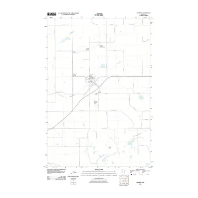
2010 Map of Henning
USGS Topo · Published 2010About this map
Henning serves as the central hub of this agricultural landscape in Otter Tail County, where a concentrated network of spiritual and civic landmarks defines the local heritage. The settlement is notable for its unusually high density of burial grounds and religious sites, including the Trinity Lutheran Church Cemetery, Norwegian Methodist Church Cemetery, and Saint Paul Cemetery, many of which sit along the edges of the town proper. These sites, along with the Henning Township Cemetery and United Cemetery, suggest a history of distinct denominational communities settling this part of Minnesota.
Find a feature on this map
48 named features on this map. Tap any name to fly to it.
Don’t see what you’re looking for? This feature index may not catch every label — zoom into the map to look around manually.
Map Details
Editions of this 2010 Henning Map
This is the sole edition of this map. No revisions or reprints were ever made.
Other maps of this area

1912 · Battle Lake
USGS Topo · 1:62,500

1914 · Battle Lake
USGS Topo · 1:62,500

1953 · Brainerd
USGS Topo · 1:250,000

1957 · Brainerd
USGS Topo · 1:250,000

1958 · Brainerd
USGS Topo · 1:250,000

1965 · Brainerd
USGS Topo · 1:250,000

1969 · Henning
USGS Topo · 1:24,000
1969 · Parkers Prairie NW
USGS Topo · 1:24,000

1969 · Henning SE
USGS Topo · 1:24,000

1969 · Heinola
USGS Topo · 1:24,000