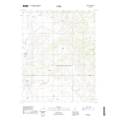
2020 Map of Henrieville
USGS Topo · Published 2020About this map
Henrieville sits at the western edge of a landscape defined by dramatic geological benches and deeply carved canyons. The town, located along Henrieville Cr, serves as a gateway to the Grand Staircase-Escalante National Monument, which dominates the central and southern portions of this terrain. To the south, the distinctive formations of Kodachrome Flat and the iconic Chimney Rock highlight the area's unique erosional history.
Find a feature on this map
33 named features on this map. Tap any name to fly to it.
Don’t see what you’re looking for? This feature index may not catch every label — zoom into the map to look around manually.
Map Details
Editions of this 2020 Henrieville Map
This is the sole edition of this map. No revisions or reprints were ever made.
Other maps of this area

1886 · Kanab
USGS Topo · 1:250,000

1886 · Escalante
USGS Topo · 1:250,000

1953 · Cedar City
USGS Topo · 1:250,000

1956 · Escalante
USGS Topo · 1:250,000

1958 · Cedar City
USGS Topo · 1:250,000

1960 · Escalante
USGS Topo · 1:250,000

1962 · Cedar City
USGS Topo · 1:250,000

1964 · Canaan Peak
USGS Topo · 1:24,000

1964 · Henrieville
USGS Topo · 1:24,000
1964 · Pine Lake
USGS Topo · 1:24,000