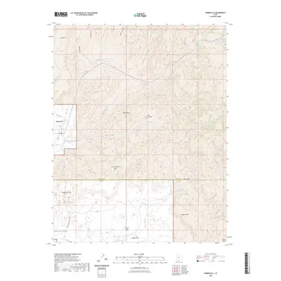
2023 Map of Henrieville
USGS Topo · Published 2023About this map
Henrieville serves as the primary settlement within this high-desert landscape of Southern Utah, situated at the junction of Henrieville Creek and Wildcat Wash. To the south, the terrain transitions into the distinct formations of Kodachrome Basin State Park, where hiking paths such as the Eagle View Trl and Panorama Loop Trl navigate the eroded features of Kodachrome Flat. The topography is defined by a series of elevated plateaus and drainage systems, including Coal Bench and the Little Creek Wood Bench. The map reveals a complex network of canyons and washes, from Jimmie Canyon in the north to the broad expanse of Big Dry Valley and Wiggler Bench near the Kane County line. This 2023 survey documents the intersection of rural ranching lands and protected natural areas, illustrating how the modern road network, including N Valley Rd, follows the natural contours of the desert floor.
Find a feature on this map
32 named features on this map. Tap any name to fly to it.
Don’t see what you’re looking for? This feature index may not catch every label — zoom into the map to look around manually.
Map Details
Editions of this 2023 Henrieville Map
This is the sole edition of this map. No revisions or reprints were ever made.
Other maps of this area

1886 · Kanab
USGS Topo · 1:250,000

1886 · Escalante
USGS Topo · 1:250,000

1953 · Cedar City
USGS Topo · 1:250,000

1956 · Escalante
USGS Topo · 1:250,000

1958 · Cedar City
USGS Topo · 1:250,000

1960 · Escalante
USGS Topo · 1:250,000

1962 · Cedar City
USGS Topo · 1:250,000

1964 · Canaan Peak
USGS Topo · 1:24,000

1964 · Henrieville
USGS Topo · 1:24,000
1964 · Pine Lake
USGS Topo · 1:24,000