
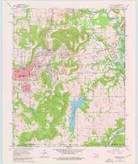
1962 Map of Henryetta
USGS Topo · Published 1963About this map
The industrial and rail identity of Okmulgee County is central to this early 1960s landscape, where the St Louis-San Francisco and Kansas Oklahoma and Gulf railroads intersect near Henryetta. The map documents a significant period of local transformation, specifically noting areas to be submerged by the Eufaula Reservoir along the Deep Fork and North Canadian River. Industrial footprints are visible at the Smelter in Spelter City, while the surrounding terrain is dotted with small settlements like Dewar, Coalton, and Kusa. Notable social and civic landmarks are well-represented, including Nichols Park, Nichols Lake, and numerous local institutions such as St Michael Sch, Jefferson Sch, and the Salem Ch. The presence of several family-named cemeteries, including Senora Cem and Salem Cem, provides valuable points of reference for genealogical research in this historic Oklahoma mining and refining district.
Find a feature on this map
56 named features on this map. Tap any name to fly to it.
Don’t see what you’re looking for? This feature index may not catch every label — zoom into the map to look around manually.
Map Details
Editions of this 1962 Henryetta Map
4 editions found
Other maps of this area

1896 · Okmulgee
USGS Topo · 1:125,000

1900 · Canadian
USGS Topo · 1:125,000

1900 · Wewoka
USGS Topo · 1:125,000

1900 · Okmulgee
USGS Topo · 1:125,000

1901 · Nuyaka
USGS Topo · 1:125,000

1946 · Fort Smith
USGS Topo · 1:250,000

1954 · Oklahoma City
USGS Topo · 1:250,000

1957 · Oklahoma City
USGS Topo · 1:250,000

1962 · Raiford
USGS Topo · 1:24,000

1962 · Henryetta SW
USGS Topo · 1:24,000