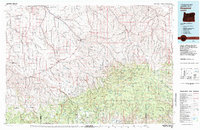
1981 Map of Heppner
USGS Topo · Published 1981About this map
Willow Creek serves as the primary drainage for this segment of the Columbia Basin, where the town of Heppner sits as the regional hub at the junction of several canyon roads. The 1980s landscape is defined by the transition from the high, arid plateaus of the north to the dense timber of the Umatilla National Forest in the south. Transportation is anchored by the Union Pacific rail line and Oregon 74, connecting smaller settlements like Lexington and Gooseberry. The terrain is deeply dissected by numerous coulees and canyons, such as Blackhorse Canyon and McKinney Canyon, which reveal the area's complex volcanic geology. High points like Arbuckle Mountain and Madison Butte offer views over a landscape marked by scattered agricultural outposts like Hardman and Lonerock, illustrating the remote character of North-Central Oregon's ranching and timber country.
Find a feature on this map
62 named features on this map. Tap any name to fly to it.
Don’t see what you’re looking for? This feature index may not catch every label — zoom into the map to look around manually.
Map Details
Editions of this 1981 Heppner Map
This is the sole edition of this map. No revisions or reprints were ever made.
Other maps of this area

1906 · Blalock Island
USGS Topo · 1:125,000

1908 · Blalock Island
USGS Topo · 1:125,000

1908 · Umatilla
USGS Topo · 1:125,000

1916 · Arlington
USGS Topo · 1:125,000

1916 · Condon
USGS Topo · 1:125,000

1926 · Mitchell
USGS Topo · 1:125,000

1935 · Pendleton
USGS Topo · 1:125,000

1950 · Ritter
USGS Topo · 1:62,500

1951 · Monument
USGS Topo · 1:62,500

1951 · Dale
USGS Topo · 1:62,500