
1914 Map of Hereford
USGS Topo · Published 1914About this map
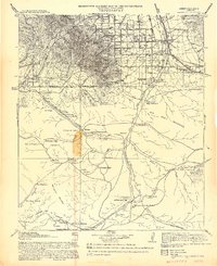
Fort Huachuca Military Reservation anchors the high desert landscape of this 1912–1913 survey, where the peaks of the Huachuca Mountains meet the ranching country of the San Pedro River valley. This era reveals a network of canyons and high summits, such as Miller Peak and Huachuca Peak, that supported both mining and early homesteading. Traces of local industry and education are visible at the Reef mine and remote outposts like Carr Canyon School and Palominas School. The El Paso and Southwestern railroad cuts through the eastern valley, connecting the settlement at Hereford with smaller stops like Stark. Near the international boundary, several homesteads including Sutherland's Ranch and the 80 Ranch illustrate the dispersed rural settlement pattern of Cochise County before the mid-century expansion.
Find a feature on this map
42 named features on this map. Tap any name to fly to it.
Don’t see what you’re looking for? This feature index may not catch every label — zoom into the map to look around manually.
Map Details
Editions of this 1914 Hereford Map
3 editions found
Other maps of this area

1902 · Bisbee
USGS Topo · 1:62,500

1904 · Patagonia
USGS Topo · 1:125,000

1905 · Patagonia
USGS Topo · 1:125,000

1905 · Nogales
USGS Topo · 1:125,000

1910 · Bisbee
USGS Topo · 1:62,500

1915 · Benson
USGS Topo · 1:125,000

1916 · Pearce
USGS Topo · 1:125,000

1916 · Douglas
USGS Topo · 1:125,000

1919 · Douglas
USGS Topo · 1:125,000

1922 · Sunnyside
USGS Topo · 1:62,500