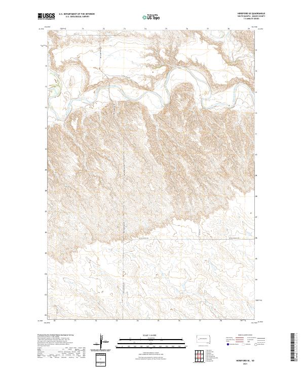
2021 Map of Hereford SE
USGS Topo · Published 2021About this map
The Belle Fourche River winds through the northern portion of this Meade County landscape, defining the local hydrology alongside several drainages including Dry Cr and Elm Cr. This 2021 survey of the Hereford SE quadrangle illustrates a rural South Dakota expanse structured by the Public Land Survey System, with township boundaries like t4n r11e and t5n r10e organizing the territory. The section lines are frequently traced by a network of local roads such as New Underwood Rd, W Elm Springs Rd, and E River View Rd. The terrain is characterized by intricate contouring that reveals the breaks and draws leading toward the river valley, offering a precise look at the modern topography of this agricultural and grazing region.
Find a feature on this map
14 named features on this map. Tap any name to fly to it.
Don’t see what you’re looking for? This feature index may not catch every label — zoom into the map to look around manually.
Map Details
Editions of this 2021 Hereford SE Map
This is the sole edition of this map. No revisions or reprints were ever made.
Other maps of this area

1953 · Viewfield
USGS Topo · 1:24,000

1953 · Hereford SE
USGS Topo · 1:24,000

1953 · Hereford
USGS Topo · 1:24,000

1953 · Hereford SW
USGS Topo · 1:24,000

1953 · Hereford NE
USGS Topo · 1:24,000
1953 · New Underwood NW
USGS Topo · 1:24,000

1953 · Rapid City
USGS Topo · 1:250,000

1954 · Elm Springs SW
USGS Topo · 1:24,000

1954 · Haydraw
USGS Topo · 1:24,000

1957 · Rapid City
USGS Topo · 1:250,000