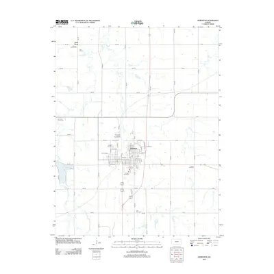
2012 Map of Herington
USGS Topo · Published 2012About this map
The Union Pacific Railroad Herington Yard stands as a central industrial feature of this Dickinson County landscape, anchoring the northern edge of Herington. This 2012 survey illustrates the town's grid and its relationship to the surrounding agricultural prairie, where several creeks, including Lyon Cr and Lime Cr, carve paths through the section lines.
Find a feature on this map
66 named features on this map. Tap any name to fly to it.
Don’t see what you’re looking for? This feature index may not catch every label — zoom into the map to look around manually.
Map Details
Editions of this 2012 Herington Map
This is the sole edition of this map. No revisions or reprints were ever made.
Other maps of this area

1889 · Abilene
USGS Topo · 1:125,000

1889 · Parkerville
USGS Topo · 1:125,000

1894 · Abilene
USGS Topo · 1:125,000

1894 · Parkerville
USGS Topo · 1:125,000

1955 · Hutchinson
USGS Topo · 1:250,000

1959 · Hutchinson
USGS Topo · 1:250,000

1964 · Ramona
USGS Topo · 1:24,000

1964 · Navarre
USGS Topo · 1:24,000

1964 · Skiddy
USGS Topo · 1:24,000
1964 · Hope
USGS Topo · 1:24,000