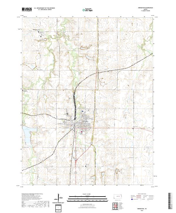
2022 Map of Herington
USGS Topo · Published 2022About this map
Herington serves as the central hub of this Kansas landscape, where a dense grid of streets like W Main St and E Logan Ave meets a network of section-line roads. The town's layout reflects its development as a regional crossroads, positioned near the western edge of the Dickinson Co Morris Co boundary line. To the west, Lake Herington provides a significant water feature, while several small tributaries including Lyon Cr, Lime Cr, and Clarks Cr wind through the surrounding farmland.
Find a feature on this map
66 named features on this map. Tap any name to fly to it.
Don’t see what you’re looking for? This feature index may not catch every label — zoom into the map to look around manually.
Map Details
Editions of this 2022 Herington Map
This is the sole edition of this map. No revisions or reprints were ever made.
Other maps of this area

1889 · Abilene
USGS Topo · 1:125,000

1889 · Parkerville
USGS Topo · 1:125,000

1894 · Abilene
USGS Topo · 1:125,000

1894 · Parkerville
USGS Topo · 1:125,000

1955 · Hutchinson
USGS Topo · 1:250,000

1959 · Hutchinson
USGS Topo · 1:250,000

1964 · Ramona
USGS Topo · 1:24,000

1964 · Navarre
USGS Topo · 1:24,000

1964 · Skiddy
USGS Topo · 1:24,000
1964 · Hope
USGS Topo · 1:24,000