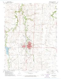
1972 Map of Herington
USGS Topo · Published 1974About this map
Herington sits at the junction of several rail lines in the early 1970s, serving as a hub where the Chicago Rock Island And Pacific and Missouri Pacific railroads intersect. The town's layout is dense with civic landmarks, from the Jr High Sch and Hospital to the local Fairground and Golf Course. On the western edge, Lake Herington provides a large recreational area including a Picnic Area, while the surrounding prairie is marked by the meandering paths of Lyon Creek and Lime Creek. Rural life is anchored by several long-standing community sites such as Immanuel Ch and St Paul Cem. To the south, the Lost Springs Oil Field indicates the region's mineral extraction history, while an Old Railroad Grade to the east hints at earlier transport alignments that once defined the Kansas landscape.
Find a feature on this map
34 named features on this map. Tap any name to fly to it.
Don’t see what you’re looking for? This feature index may not catch every label — zoom into the map to look around manually.
Map Details
Editions of this 1972 Herington Map
This is the sole edition of this map. No revisions or reprints were ever made.
Other maps of this area

1889 · Abilene
USGS Topo · 1:125,000

1889 · Parkerville
USGS Topo · 1:125,000

1894 · Abilene
USGS Topo · 1:125,000

1894 · Parkerville
USGS Topo · 1:125,000

1955 · Hutchinson
USGS Topo · 1:250,000

1959 · Hutchinson
USGS Topo · 1:250,000

1964 · Ramona
USGS Topo · 1:24,000

1964 · Navarre
USGS Topo · 1:24,000

1964 · Skiddy
USGS Topo · 1:24,000
1964 · Hope
USGS Topo · 1:24,000