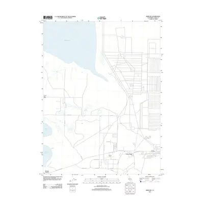
2012 Map of Herlong
USGS Topo · Published 2012About this map
Honey Lake dominates the northwestern portion of this Lassen County landscape, marking the floor of the Honey Lake Valley. The eastern half of the sheet is defined by the highly structured layout of the Sierra Army Depot, a massive military installation that has long served as the region's primary economic driver. Adjacent to the depot, the residential settlements of Herlong and Patton Village provide housing for personnel and their families, while Herlong Junction sits further west where the Herlong Access Rd meets the regional transit network. The arid terrain between the lake and the base is punctuated by landmarks like Sheep Springs and the Herlong Airport, connected by a grid of named routes including Sage Valley Rd and Susanville Rd. This map reflects the intersection of a sensitive high-desert basin with a significant 21st-century military infrastructure.
Find a feature on this map
25 named features on this map. Tap any name to fly to it.
Don’t see what you’re looking for? This feature index may not catch every label — zoom into the map to look around manually.
Map Details
Editions of this 2012 Herlong Map
This is the sole edition of this map. No revisions or reprints were ever made.
Other maps of this area

1886 · Honey Lake
USGS Topo · 1:250,000

1891 · Honey Lake
USGS Topo · 1:250,000

1893 · Honey Lake
USGS Topo · 1:250,000

1950 · Milford
USGS Topo · 1:62,500

1954 · Wendel
USGS Topo · 1:62,500

1954 · Litchfield
USGS Topo · 1:62,500

1954 · Doyle
USGS Topo · 1:62,500

1955 · Westwood
USGS Topo · 1:250,000

1958 · Westwood
USGS Topo · 1:250,000

1959 · Westwood
USGS Topo · 1:250,000