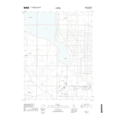
2018 Map of Herlong
USGS Topo · Published 2018About this map
Honey Lake dominates the northern landscape of this Lassen County region, its shoreline defining the transition into the Honey Lake Valley. The settlement patterns here reflect a mix of established community centers and aviation infrastructure, anchored by the residential layouts of Herlong and Patton Village. South of the lake, the terrain is marked by hydrological features such as Sheep Springs and the winding course of Long Valley Cr, which cut through the open basin. A dense network of local roads like CO Hwy A25 and Herlong Access Rd connects the residential districts to the Herlong Airport, illustrating the organized development of this high-desert environment during the late twenty-first century. The presence of The Island further distinguishes the unique geography found along the lake's edge.
Find a feature on this map
39 named features on this map. Tap any name to fly to it.
Don’t see what you’re looking for? This feature index may not catch every label — zoom into the map to look around manually.
Map Details
Editions of this 2018 Herlong Map
This is the sole edition of this map. No revisions or reprints were ever made.
Other maps of this area

1886 · Honey Lake
USGS Topo · 1:250,000

1891 · Honey Lake
USGS Topo · 1:250,000

1893 · Honey Lake
USGS Topo · 1:250,000

1950 · Milford
USGS Topo · 1:62,500

1954 · Wendel
USGS Topo · 1:62,500

1954 · Litchfield
USGS Topo · 1:62,500

1954 · Doyle
USGS Topo · 1:62,500

1955 · Westwood
USGS Topo · 1:250,000

1958 · Westwood
USGS Topo · 1:250,000

1959 · Westwood
USGS Topo · 1:250,000