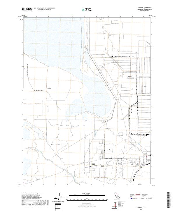
2021 Map of Herlong
USGS Topo · Published 2021About this map
Honey Lake dominates the northern expanse of this survey, marking a seasonal and shifting shoreline within the broader Honey Lake Valley. The landscape is defined by its transition from the alkaline lake bed and The Island to the structured grid of the high desert settlements in the south. The community of Herlong is detailed with its residential street network, including David S Hall Ave and Pacific St, situated near Patton Village. This area represents a significant intersection of logistics and remote settlement, supported by the Herlong Airport and a series of regional connectors like Co Hwy A-25. Hydrological features such as Sheep Springs and the winding course of Long Valley Cr suggest the vital role of water management in this arid Lassen County basin.
Find a feature on this map
40 named features on this map. Tap any name to fly to it.
Don’t see what you’re looking for? This feature index may not catch every label — zoom into the map to look around manually.
Map Details
Editions of this 2021 Herlong Map
This is the sole edition of this map. No revisions or reprints were ever made.
Other maps of this area

1886 · Honey Lake
USGS Topo · 1:250,000

1891 · Honey Lake
USGS Topo · 1:250,000

1893 · Honey Lake
USGS Topo · 1:250,000

1950 · Milford
USGS Topo · 1:62,500

1954 · Wendel
USGS Topo · 1:62,500

1954 · Litchfield
USGS Topo · 1:62,500

1954 · Doyle
USGS Topo · 1:62,500

1955 · Westwood
USGS Topo · 1:250,000

1958 · Westwood
USGS Topo · 1:250,000

1959 · Westwood
USGS Topo · 1:250,000