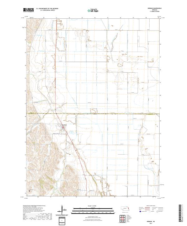
2021 Map of Herman
USGS Topo · Published 2021About this map
Herman sits at the heart of this landscape, where the flat agricultural terrain of the Missouri River valley meets the rising bluffs to the west. The village is organized around Main St and West St, with Herman School Rd extending into the surrounding countryside. This 2021 survey reveals an intricate network of drainage infrastructure essential to the region's farming economy, featuring numerous engineered waterways such as County Line Ditch, Greenleaf Ditch, Cameron Ditch, and Harney Slough Ditch. These ditches work in tandem with natural drainages like New York Cr and Whittier Cr to manage the hydrology of the lowlands.
Find a feature on this map
64 named features on this map. Tap any name to fly to it.
Don’t see what you’re looking for? This feature index may not catch every label — zoom into the map to look around manually.
Map Details
Editions of this 2021 Herman Map
This is the sole edition of this map. No revisions or reprints were ever made.
Other maps of this area

1955 · Fremont
USGS Topo · 1:250,000

1957 · Fremont
USGS Topo · 1:250,000

1958 · Fremont
USGS Topo · 1:250,000
1969 · Orum
USGS Topo · 1:24,000

1970 · Oakland SE
USGS Topo · 1:24,000

1970 · Little Sioux
USGS Topo · 1:24,000

1970 · Herman
USGS Topo · 1:24,000

1970 · Mondamin
USGS Topo · 1:24,000
1970 · Modale
USGS Topo · 1:24,000
1970 · Nickerson NE
USGS Topo · 1:24,000