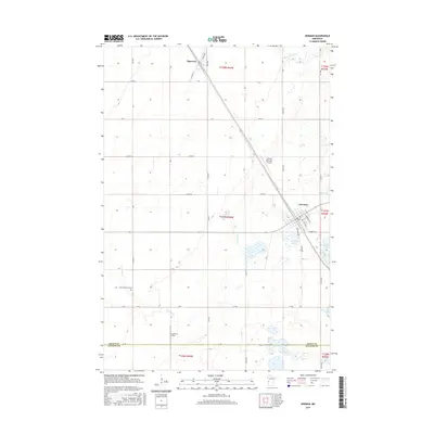
2016 Map of Herman
USGS Topo · Published 2016About this map
Herman and Norcross anchor this section of West Central Minnesota, situated on the flat, glaciated plains where Grant and Stevens counties meet. The landscape is defined by its rectilinear grid of section-line roads like Co Rd 32 and Co Hwy 11, characteristic of intensive prairie agriculture. Aviation history is visible in the presence of both the Herman Municipal Airport and the smaller Itzen Air Strip, reflecting the practical necessity of private and municipal flight in this open country.
Find a feature on this map
48 named features on this map. Tap any name to fly to it.
Don’t see what you’re looking for? This feature index may not catch every label — zoom into the map to look around manually.
Map Details
Editions of this 2016 Herman Map
This is the sole edition of this map. No revisions or reprints were ever made.
Other maps of this area

1910 · Chokio
USGS Topo · 1:62,500

1911 · Herman
USGS Topo · 1:62,500

1912 · Chokio
USGS Topo · 1:62,500

1950 · Graceville
USGS Topo · 1:62,500

1951 · Wheaton
USGS Topo · 1:62,500

1953 · Milbank
USGS Topo · 1:250,000

1958 · Milbank
USGS Topo · 1:250,000

1973 · Herman NW
USGS Topo · 1:24,000
1973 · Herman
USGS Topo · 1:24,000
1973 · Donnelly
USGS Topo · 1:24,000