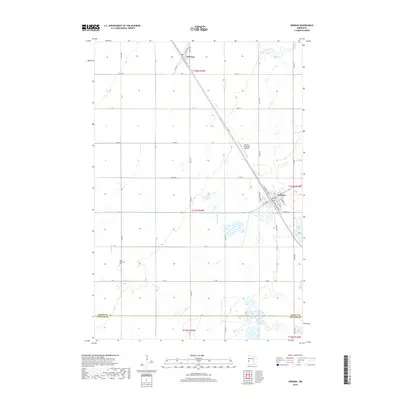
2019 Map of Herman
USGS Topo · Published 2019About this map
Herman and Norcross anchor this agricultural landscape in Grant County, where the grid of rural roads meets a series of glacial lakes and prairie waterways. The town of Herman serves as a local hub, featuring a dense network of streets like Atlantic Aven and Hamburg Ave S near the southern edge of town. South of the main settlement, the Eden Reformed Ch and its accompanying Eden Reformed Cem provide a focal point for local genealogy and community history. The terrain is defined by the winding course of the Mustinka River in the north and the drainage of Fivemile Cr, which feeds into wetland areas near Pullman Lake and Nelson Lake. These natural features, along with the Herman Municipal Airport, illustrate the modern balance of transport, agriculture, and conservation near the Stevens County line.
Find a feature on this map
36 named features on this map. Tap any name to fly to it.
Don’t see what you’re looking for? This feature index may not catch every label — zoom into the map to look around manually.
Map Details
Editions of this 2019 Herman Map
This is the sole edition of this map. No revisions or reprints were ever made.
Other maps of this area

1910 · Chokio
USGS Topo · 1:62,500

1911 · Herman
USGS Topo · 1:62,500

1912 · Chokio
USGS Topo · 1:62,500

1950 · Graceville
USGS Topo · 1:62,500

1951 · Wheaton
USGS Topo · 1:62,500

1953 · Milbank
USGS Topo · 1:250,000

1958 · Milbank
USGS Topo · 1:250,000

1973 · Herman NW
USGS Topo · 1:24,000
1973 · Herman
USGS Topo · 1:24,000
1973 · Donnelly
USGS Topo · 1:24,000