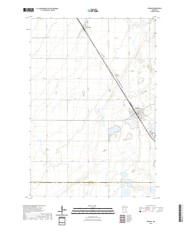
2022 Map of Herman
USGS Topo · Published 2022About this map
Herman and Norcross anchor this section of West Central Minnesota, revealing a landscape defined by organized township grids and glacial hydrology. The prairie terrain is cut by the Mustinka River in the northeast and Fivemile Cr further south, with local depressions forming Pullman Lake and Nelson Lake. These water features influenced the early development of the region's agricultural infrastructure, seen here in the dense network of township roads like Co Hwy 8 and Co Rd 32.
Find a feature on this map
50 named features on this map. Tap any name to fly to it.
Don’t see what you’re looking for? This feature index may not catch every label — zoom into the map to look around manually.
Map Details
Editions of this 2022 Herman Map
This is the sole edition of this map. No revisions or reprints were ever made.
Other maps of this area

1910 · Chokio
USGS Topo · 1:62,500

1911 · Herman
USGS Topo · 1:62,500

1912 · Chokio
USGS Topo · 1:62,500

1950 · Graceville
USGS Topo · 1:62,500

1951 · Wheaton
USGS Topo · 1:62,500

1953 · Milbank
USGS Topo · 1:250,000

1958 · Milbank
USGS Topo · 1:250,000

1973 · Herman NW
USGS Topo · 1:24,000
1973 · Herman
USGS Topo · 1:24,000
1973 · Donnelly
USGS Topo · 1:24,000