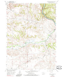
1950 Map of Herman Ranch
USGS Topo · Published 1985About this map
The Emigrant Trail cuts a diagonal path across this high plains landscape, marking the historic westward migration route as it follows the drainage of Cottonwood Creek. Published in the mid-20th century but based on earlier field checks, this map captures the transition of the Platte County terrain from pioneer passage to established ranching operations. Isolated gravesites and an Oregon Trail Marker stand as quiet reminders of the 19th-century travelers who once moved parallel to what became the Colorado and Southern railroad line.
Find a feature on this map
16 named features on this map. Tap any name to fly to it.
Don’t see what you’re looking for? This feature index may not catch every label — zoom into the map to look around manually.
Map Details
Editions of this 1950 Herman Ranch Map
3 editions found
Other maps of this area

1896 · Hartville
USGS Topo · 1:125,000

1901 · Hartville
USGS Topo · 1:125,000

1950 · Coleman Butte
USGS Topo · 1:24,000

1950 · Herman Ranch
USGS Topo · 1:24,000

1950 · Haushar Ranch
USGS Topo · 1:24,000

1950 · Guernsey Reservoir
USGS Topo · 1:24,000

1951 · Coleman Butte
USGS Topo · 1:24,000

1951 · Sibley Peak
USGS Topo · 1:24,000

1951 · Haushar Ranch
USGS Topo · 1:24,000

1951 · Guernsey Reservoir
USGS Topo · 1:24,000