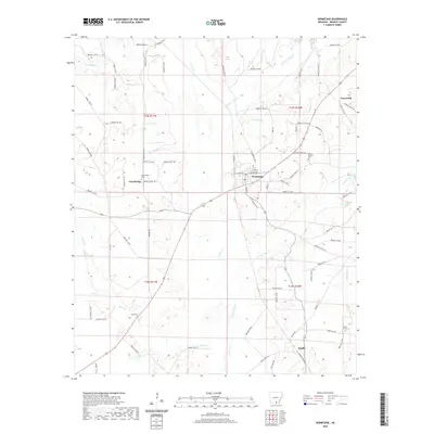
2020 Map of Hermitage
USGS Topo · Published 2020About this map
Hermitage serves as the central hub of this Bradley County landscape, situated at a crossroads where the local road network converges. The area is defined by a dense system of waterways, including the winding course of L'Aigle Cr and its tributaries like Brushy L'Aigle Cr and Threemile Br. Smaller settlements and neighborhood clusters such as Greenville, Ingalls, and Gravelridge are scattered throughout the timber and agricultural lands, often identified by their proximity to local landmarks. For those tracing family histories, the map identifies several distinct burial sites including Gravelridge Cem, Holly Springs Cem, and Neal Cem. The southern reaches are characterized by the low-lying drainage of Grassy Pond Cr and Beech Cr, illustrating the typical hydrology of the West Gulf Coastal Plain before these waters reach larger basins to the south.
Find a feature on this map
85 named features on this map. Tap any name to fly to it.
Don’t see what you’re looking for? This feature index may not catch every label — zoom into the map to look around manually.
Map Details
Editions of this 2020 Hermitage Map
This is the sole edition of this map. No revisions or reprints were ever made.
Other maps of this area

1934 · Ingalls
USGS Topo · 1:48,000

1934 · Moro Bay
USGS Topo · 1:62,500

1937 · Ingalls
USGS Topo · 1:62,500

1938 · Moro Bay
USGS Topo · 1:62,500

1939 · Moro Bay
USGS Topo · 1:62,500

1939 · Ingalls
USGS Topo · 1:62,500

1953 · El Dorado
USGS Topo · 1:250,000

1957 · El Dorado
USGS Topo · 1:250,000

1958 · El Dorado
USGS Topo · 1:250,000

1960 · El Dorado
USGS Topo · 1:250,000