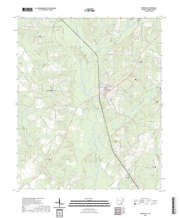
2024 Map of Hermitage
USGS Topo · Published 2024About this map
Hermitage stands as a central hub in this section of Bradley County, where a dense network of local roads radiates into the surrounding timberlands and creek bottoms. The landscape is defined by the winding paths of L'Aigle Creek and its tributaries, such as Brushy L'Aigle Creek and Threemite Branch, which carve through the terrain. To the west, the settlement of Gravelridge is marked by the nearby Gravel Ridge Cem, reflecting a long history of local habitation.
Find a feature on this map
84 named features on this map. Tap any name to fly to it.
Don’t see what you’re looking for? This feature index may not catch every label — zoom into the map to look around manually.
Map Details
Editions of this 2024 Hermitage Map
This is the sole edition of this map. No revisions or reprints were ever made.
Other maps of this area

1934 · Ingalls
USGS Topo · 1:48,000

1934 · Moro Bay
USGS Topo · 1:62,500

1937 · Ingalls
USGS Topo · 1:62,500

1938 · Moro Bay
USGS Topo · 1:62,500

1939 · Moro Bay
USGS Topo · 1:62,500

1939 · Ingalls
USGS Topo · 1:62,500

1953 · El Dorado
USGS Topo · 1:250,000

1957 · El Dorado
USGS Topo · 1:250,000

1958 · El Dorado
USGS Topo · 1:250,000

1960 · El Dorado
USGS Topo · 1:250,000