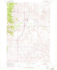
1953 Map of Hermosa
USGS Topo · Published 1972About this map
Hermosa sits at the junction of rail and river in the mid-1950s, serving as a focal point for the surrounding Black Hills ranching country. The Chicago and North Western railroad bisects the landscape, running parallel to the north-south drainage of Billover Creek and passing directly through the heart of the settlement. The convergence of Battle Creek and Grace Coolidge Creek south of town underscores the importance of reliable water sources in this environment, where the land is marked by numerous Windmill sites and a localized Reservoir.
Find a feature on this map
13 named features on this map. Tap any name to fly to it.
Don’t see what you’re looking for? This feature index may not catch every label — zoom into the map to look around manually.
Map Details
Editions of this 1953 Hermosa Map
3 editions found
Other maps of this area

1894 · Hermosa
USGS Topo · 1:125,000

1901 · Hermosa
USGS Topo · 1:125,000

1953 · Hermosa NW
USGS Topo · 1:24,000

1953 · Hermosa
USGS Topo · 1:24,000

1953 · Hermosa SE
USGS Topo · 1:24,000
1953 · Hermosa NE
USGS Topo · 1:24,000
1954 · Rockerville
USGS Topo · 1:24,000

1954 · Hayward
USGS Topo · 1:24,000

1954 · Mount Rushmore
USGS Topo · 1:62,500

1955 · Hot Springs
USGS Topo · 1:250,000