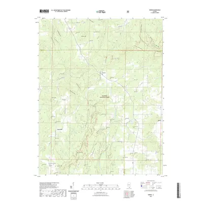
2021 Map of Herod
USGS Topo · Published 2021About this map
Shawnee National Forest encompasses the majority of this landscape in southern Illinois, where the hills of Pope and Hardin counties meet. The small community of Herod sits at a crossroads of forest roads and trails, serving as a gateway to the complex terrain of Wamble Mtn and Horton Hill. This survey documents a high concentration of family and community burial grounds, such as Asbell Cem, Sturgill Cem, and Old Grandpier Cem, which offer significant value for genealogical research in this rural region.
Find a feature on this map
94 named features on this map. Tap any name to fly to it.
Don’t see what you’re looking for? This feature index may not catch every label — zoom into the map to look around manually.
Map Details
Editions of this 2021 Herod Map
This is the sole edition of this map. No revisions or reprints were ever made.
Other maps of this area

1916 · Golconda
USGS Topo · 1:62,500

1916 · Equality
USGS Topo · 1:62,500

1917 · Brownfield
USGS Topo · 1:62,500

1920 · Goloonda
USGS Topo · 1:48,000

1921 · Golconda
USGS Topo · 1:62,500

1925 · Harrisburg
USGS Topo · 1:62,500

1939 · Harrisburg
USGS Topo · 1:62,500

1949 · Paducah
USGS Topo · 1:250,000

1950 · Paducah
USGS Topo · 1:250,000

1954 · Paducah
USGS Topo · 1:250,000