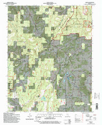
1996 Map of Herod
USGS Topo · Published 1998About this map
Shawnee National Forest dominates this landscape, where the southern Illinois hills meet a legacy of rural settlement and resource extraction. The area around Herod and Hartsville is defined by its deep connectivity to the land, featuring numerous family and church burial grounds such as Old Grand Pierre Cem, Lavender Cem, and Fulkerson Cem. The terrain is marked by significant elevations like Williams Hill and Wamble Mountain, alongside the distinctive passage at One Horse Gap.
Find a feature on this map
62 named features on this map. Tap any name to fly to it.
Don’t see what you’re looking for? This feature index may not catch every label — zoom into the map to look around manually.
Map Details
Editions of this 1996 Herod Map
This is the sole edition of this map. No revisions or reprints were ever made.
Other maps of this area

1916 · Golconda
USGS Topo · 1:62,500

1916 · Equality
USGS Topo · 1:62,500

1917 · Brownfield
USGS Topo · 1:62,500

1920 · Goloonda
USGS Topo · 1:48,000

1921 · Golconda
USGS Topo · 1:62,500

1925 · Harrisburg
USGS Topo · 1:62,500

1939 · Harrisburg
USGS Topo · 1:62,500

1949 · Paducah
USGS Topo · 1:250,000

1950 · Paducah
USGS Topo · 1:250,000

1954 · Paducah
USGS Topo · 1:250,000