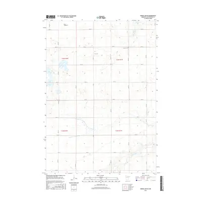
2016 Map of Heron Lake NE
USGS Topo · Published 2016About this map
Amo Cem and United Amo Cem stand as significant local markers in this rural portion of Cottonwood County, where the landscape is defined by its glacial history and agricultural drainage. The northern reaches of the quadrangle feature a cluster of water bodies including Augusta Lake, Little Lake, and the dry Berry Lakebed, reflecting the complex hydrology of the region. A section of the Des Moines River meanders through the southeast corner, while the County Ditch Number Twentynine illustrates the engineered water management vital to the local farming economy. This survey documents the rectilinear road grid, from Co Rd 5 to Co Rd 13, which organizes the farmsteads and townships in the years following the turn of the 21st century.
Find a feature on this map
32 named features on this map. Tap any name to fly to it.
Don’t see what you’re looking for? This feature index may not catch every label — zoom into the map to look around manually.
Map Details
Editions of this 2016 Heron Lake NE Map
This is the sole edition of this map. No revisions or reprints were ever made.
Other maps of this area

1953 · New Ulm
USGS Topo · 1:250,000

1954 · Fairmont
USGS Topo · 1:250,000

1957 · New Ulm
USGS Topo · 1:250,000

1958 · New Ulm
USGS Topo · 1:250,000

1958 · Fairmont
USGS Topo · 1:250,000

1967 · New Ulm
USGS Topo · 1:250,000

1967 · Storden
USGS Topo · 1:24,000

1967 · Jeffers
USGS Topo · 1:24,000
1967 · Westbrook
USGS Topo · 1:24,000

1970 · Heron Lake NW
USGS Topo · 1:24,000