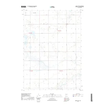
2019 Map of Heron Lake NE
USGS Topo · Published 2019About this map
The Des Moines River winds through the southern portion of this Cottonwood County landscape, carving a natural path across a territory defined by a rigorous section-line road grid. This intersection of natural hydrology and human surveying is evident in the sprawling wetlands and small prairie basins that dot the northern sections, including Berry Lake, Little Lake, and the adjacent waters of Long Lake and Round Lake.
Find a feature on this map
23 named features on this map. Tap any name to fly to it.
Don’t see what you’re looking for? This feature index may not catch every label — zoom into the map to look around manually.
Map Details
Editions of this 2019 Heron Lake NE Map
This is the sole edition of this map. No revisions or reprints were ever made.
Other maps of this area

1953 · New Ulm
USGS Topo · 1:250,000

1954 · Fairmont
USGS Topo · 1:250,000

1957 · New Ulm
USGS Topo · 1:250,000

1958 · New Ulm
USGS Topo · 1:250,000

1958 · Fairmont
USGS Topo · 1:250,000

1967 · New Ulm
USGS Topo · 1:250,000

1967 · Storden
USGS Topo · 1:24,000

1967 · Jeffers
USGS Topo · 1:24,000
1967 · Westbrook
USGS Topo · 1:24,000

1970 · Heron Lake NW
USGS Topo · 1:24,000