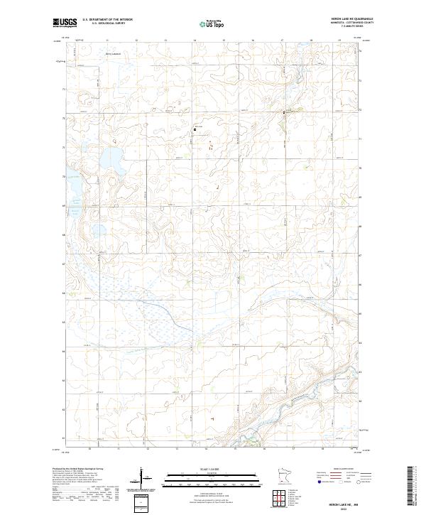
2022 Map of Heron Lake NE
USGS Topo · Published 2022About this map
The Des Moines River winds through the southeastern corner of this Cottonwood County landscape, providing a sharp contrast to the geometric agricultural grid that defines the rest of the territory. The rural character of the region is anchored by long-standing landmarks like Amo Cem and United Amo Cem, which serve as vital points of reference for genealogists tracing family roots in the area. The terrain is characterized by numerous glacial depressions, including the remnants of Berry Lakebed and smaller bodies of water such as Little Lake, Long Lake, and Round Lake.
Find a feature on this map
23 named features on this map. Tap any name to fly to it.
Don’t see what you’re looking for? This feature index may not catch every label — zoom into the map to look around manually.
Map Details
Editions of this 2022 Heron Lake NE Map
This is the sole edition of this map. No revisions or reprints were ever made.
Other maps of this area

1953 · New Ulm
USGS Topo · 1:250,000

1954 · Fairmont
USGS Topo · 1:250,000

1957 · New Ulm
USGS Topo · 1:250,000

1958 · New Ulm
USGS Topo · 1:250,000

1958 · Fairmont
USGS Topo · 1:250,000

1967 · New Ulm
USGS Topo · 1:250,000

1967 · Storden
USGS Topo · 1:24,000

1967 · Jeffers
USGS Topo · 1:24,000
1967 · Westbrook
USGS Topo · 1:24,000

1970 · Heron Lake NW
USGS Topo · 1:24,000