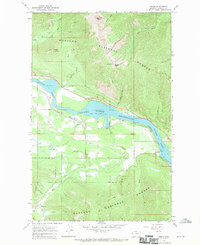
1966 Map of Heron
USGS Topo · Published 1970About this map
The Northern Pacific railroad tracks trace the southern bank of the Cabinet Gorge Reservoir in this mid-1960s study of western Montana. The small settlement of Heron serves as a primary point of interest, situated near a Cem and a network of local roads that bridge the gap between the water and the rising terrain of the Kaniksu National Forest. The landscape is dominated by the flooded valley of the Clark Fork, which is fed by numerous tributaries including Blue Creek, Elk Creek, and Dead Horse Creek. High elevations are marked by distinctive landmarks such as the Squaw Peak Lookout Tower and the curiously named Billiard Table. Evidence of local industry and resource extraction is found in the Brown Hill Mine and several Gravel Pits scattered near the riverbanks.
Find a feature on this map
72 named features on this map. Tap any name to fly to it.
Don’t see what you’re looking for? This feature index may not catch every label — zoom into the map to look around manually.
Map Details
Editions of this 1966 Heron Map
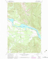
2 editions found
Other maps of this area

1909 · Cataldo
USGS Topo · 1:125,000

1911 · Cataldo
USGS Topo · 1:125,000

1911 · Priest Lake
USGS Topo · 1:250,000

1913 · Priest Lake
USGS Topo · 1:250,000

1920 · Libby
USGS Topo · 1:125,000

1930 · Libby
USGS Topo · 1:125,000

1932 · Libby
USGS Topo · 1:125,000

1932 · Trout Creek
USGS Topo · 1:125,000

1935 · Trout Creek
USGS Topo · 1:125,000

1936 · Trout Creek
USGS Topo · 1:125,000