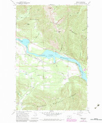
1966 Map of Heron
USGS Topo · Published 1984About this map
Heron sits along the northern bank of the Clark Fork in a valley dominated by the Cabinet Gorge Reservoir. This map, based on 1960s field work with early 1980s updates, shows the town's position between the steep slopes of the Kaniksu National Forest and the vital corridor of the Burlington Northern railroad. The landscape reflects a mix of resource extraction and infrastructure, with the Brown Hill Mine and several Gravel Pits dotting the mountainous terrain. Notable landmarks like the Lookout Tower on Squaw Peak and the curiously named Billiard Table peak overlook the winding drainages of Blue Creek and Elk Creek. The presence of a local Cem and numerous bench marks, such as BM 2253, provides specific points of interest for genealogists and researchers mapping the historical footprint of this riverfront settlement.
Find a feature on this map
39 named features on this map. Tap any name to fly to it.
Don’t see what you’re looking for? This feature index may not catch every label — zoom into the map to look around manually.
Map Details
Editions of this 1966 Heron Map
2 editions found
Other maps of this area

1909 · Cataldo
USGS Topo · 1:125,000

1911 · Cataldo
USGS Topo · 1:125,000

1911 · Priest Lake
USGS Topo · 1:250,000

1913 · Priest Lake
USGS Topo · 1:250,000

1920 · Libby
USGS Topo · 1:125,000

1930 · Libby
USGS Topo · 1:125,000

1932 · Libby
USGS Topo · 1:125,000

1932 · Trout Creek
USGS Topo · 1:125,000

1935 · Trout Creek
USGS Topo · 1:125,000

1936 · Trout Creek
USGS Topo · 1:125,000