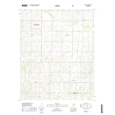
2018 Map of Herring
USGS Topo · Published 2018About this map
Black Kettle National Grassland dominates the northwestern portion of this 2018 survey, reflecting the complex management of public and private lands in the Oklahoma panhandle region. The small settlement of Herring is situated in the north-central area, while the rural landscape to the south is defined by a dense network of watercourses and section roads. The Washita River cuts through the northern sections, joined by tributaries like Beaverdam Cr, while the southern reaches are drained by Sandstone Cr and the E Fork Sandstone Cr. This map captures a modern view of the ranching and agricultural life near the boundary of Roger Mills and Beckham County, where landmarks like the Sandstone Cem and Taylor Lake serve as key points of reference for local families. The grid of section roads, including Taylor Ranch Rd and D1890 Rd, provides a clear view of land division and access across this prairie landscape.
Find a feature on this map
32 named features on this map. Tap any name to fly to it.
Don’t see what you’re looking for? This feature index may not catch every label — zoom into the map to look around manually.
Map Details
Editions of this 2018 Herring Map
This is the sole edition of this map. No revisions or reprints were ever made.
Other maps of this area

1955 · Clinton
USGS Topo · 1:250,000

1957 · Clinton
USGS Topo · 1:250,000

1960 · Cheyenne
USGS Topo · 1:62,500

1960 · Sayre
USGS Topo · 1:62,500

1960 · Hammon
USGS Topo · 1:62,500

1961 · Elk City
USGS Topo · 1:62,500

1984 · Foss Reservoir
USGS Topo · 1:100,000

1985 · Elk City
USGS Topo · 1:100,000

1987 · Big Kiowa Creek
USGS Topo · 1:24,000

1987 · Elk City
USGS Topo · 1:24,000