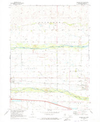
1970 Map of Hershey East
USGS Topo · Published 1973About this map
The Union Pacific railroad and the dual branches of the Platte define this stretch of Lincoln County, where the village of Hershey serves as a central hub for the surrounding agricultural townships. The landscape is a complex network of water management, featuring the North Platte Canal and Birdwood Canal alongside natural features like Beer Slough and Fremont Slough. These man-made diversions, marked by numerous flumes and a Pumping Station, underscore the region's reliance on irrigation to sustain its plains economy.
Find a feature on this map
27 named features on this map. Tap any name to fly to it.
Don’t see what you’re looking for? This feature index may not catch every label — zoom into the map to look around manually.
Map Details
Editions of this 1970 Hershey East Map
This is the sole edition of this map. No revisions or reprints were ever made.
Other maps of this area

1898 · Paxton
USGS Topo · 1:125,000

1899 · North Platte
USGS Topo · 1:125,000

1901 · Paxton
USGS Topo · 1:125,000

1902 · North Platte
USGS Topo · 1:125,000

1954 · North Platte
USGS Topo · 1:250,000

1956 · North Platte
USGS Topo · 1:250,000

1957 · North Platte
USGS Topo · 1:250,000

1967 · North Platte
USGS Topo · 1:250,000

1970 · North Platte West
USGS Topo · 1:24,000
1970 · North Platte SW
USGS Topo · 1:24,000