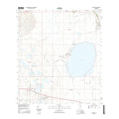
2015 Map of Hesperides
USGS Topo · Published 2015About this map
Hesperides and Alcoma serve as the primary focal points of this central Florida landscape, where citrus-era settlement patterns meet an extensive network of freshwater lakes. The hydrology of the area is dominated by the massive Lake Rosalie, which is connected to the Kissimmee River system through Weohyakapka Cr and Rosalie Cr. This 2015 survey reveals a terrain defined by its water bodies, ranging from the large Lake Hatchineha on the northeastern boundary to smaller, sequestered basins like Swim Lake, Saddlebag Lake, and Lake Aurora.
Find a feature on this map
63 named features on this map. Tap any name to fly to it.
Don’t see what you’re looking for? This feature index may not catch every label — zoom into the map to look around manually.
Map Details
Editions of this 2015 Hesperides Map
This is the sole edition of this map. No revisions or reprints were ever made.
Other maps of this area

1952 · Lake Wales
USGS Topo · 1:24,000

1952 · Lake Weohyakapka SE
USGS Topo · 1:24,000

1952 · Lake Weohyakapka NE
USGS Topo · 1:24,000

1952 · Babson Park
USGS Topo · 1:24,000

1952 · Hesperides
USGS Topo · 1:24,000

1952 · Lake Weohyakapka
USGS Topo · 1:24,000

1953 · Cypress Lake
USGS Topo · 1:24,000

1953 · Dundee
USGS Topo · 1:24,000

1953 · Lake Hatchineha
USGS Topo · 1:24,000

1955 · Orlando
USGS Topo · 1:250,000