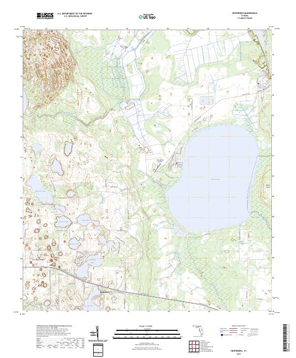
2024 Map of Hesperides
USGS Topo · Published 2024About this map
Lake Rosalie dominates the central landscape of this Polk County region, surrounded by a complex network of wetlands and smaller basins including Big Gum Lake, Cypress Lake, and Thomas Lake. The terrain is defined by the Lake Wales Ridge, which influences the local hydrology as water moves toward the Kissimmee River on the eastern boundary. The small settlements of Hesperides and Alcoma serve as focal points for the road network, which includes Hesperides Rd and Camp Mack Rd.
Find a feature on this map
77 named features on this map. Tap any name to fly to it.
Don’t see what you’re looking for? This feature index may not catch every label — zoom into the map to look around manually.
Map Details
Editions of this 2024 Hesperides Map
This is the sole edition of this map. No revisions or reprints were ever made.
Other maps of this area

1952 · Lake Wales
USGS Topo · 1:24,000

1952 · Lake Weohyakapka SE
USGS Topo · 1:24,000

1952 · Lake Weohyakapka NE
USGS Topo · 1:24,000

1952 · Babson Park
USGS Topo · 1:24,000

1952 · Hesperides
USGS Topo · 1:24,000

1952 · Lake Weohyakapka
USGS Topo · 1:24,000

1953 · Cypress Lake
USGS Topo · 1:24,000

1953 · Dundee
USGS Topo · 1:24,000

1953 · Lake Hatchineha
USGS Topo · 1:24,000

1955 · Orlando
USGS Topo · 1:250,000