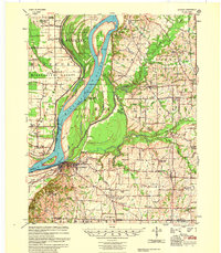
1955 Map of Hickman
USGS Topo · Published 1955About this map
Hickman sits as the focal point of this riverfront landscape, positioned where the Mississippi River creates the sharp Hickman Bend. This mid-century survey reveals a sophisticated river economy, marked by numerous landings such as Muscovalley Ldg and Dorena Ldg along the shifting banks. The intricate hydrology of Fulton County is evident in the meandering Bayou de Chien and the Obion River, which shape the low-lying terrain near the Tennessee state line.
Find a feature on this map
101 named features on this map. Tap any name to fly to it.
Don’t see what you’re looking for? This feature index may not catch every label — zoom into the map to look around manually.
Map Details
Editions of this 1955 Hickman Map
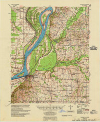
2 editions found
Other maps of this area

1925 · Reelfoot Lake
USGS Topo · 1:62,500

1939 · Wickliffe
USGS Topo · 1:62,500

1939 · Reelfoot Lake
USGS Topo · 1:62,500

1939 · Charleston
USGS Topo · 1:62,500

1939 · Hickman
USGS Topo · 1:62,500

1939 · Bayouville
USGS Topo · 1:62,500

1951 · Cayce
USGS Topo · 1:24,000

1951 · Bondurant
USGS Topo · 1:24,000

1951 · Oakton
USGS Topo · 1:24,000

1951 · Hickman
USGS Topo · 1:24,000