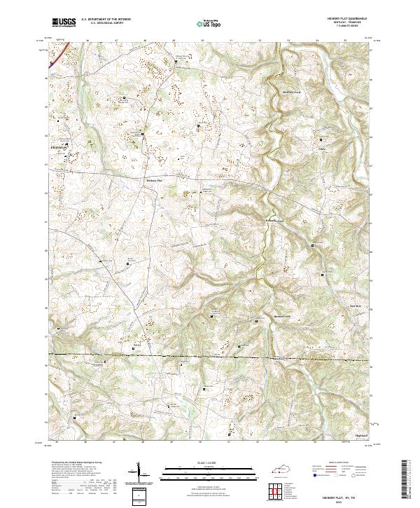
2022 Map of Hickory Flat
USGS Topo · Published 2022About this map
Hickory Flat and the surrounding borderlands of Kentucky and Tennessee are defined by a complex network of small rural settlements and religious sites. This modern survey illustrates how long-standing community hubs like New Roe and Clare continue to anchor the region, even as the landscape remains predominantly agricultural and divided by rolling creek drainages. Significant for genealogists, the map identifies a high density of family and church burial grounds, including the Old Loving Chapel Cem, Bethany Church of Christ Cem, and the Shady Grove Baptist Church Cem.
Find a feature on this map
111 named features on this map. Tap any name to fly to it.
Don’t see what you’re looking for? This feature index may not catch every label — zoom into the map to look around manually.
Map Details
Editions of this 2022 Hickory Flat Map
This is the sole edition of this map. No revisions or reprints were ever made.
Other maps of this area

1921 · Bowling Green
USGS Topo · 1:62,500

1923 · Bowling Green
USGS Topo · 1:62,500

1928 · Adolphus
USGS Topo · 1:48,000

1931 · Adolphus
USGS Topo · 1:62,500

1942 · Gallatin
USGS Topo · 1:100,000

1951 · Woodburn
USGS Topo · 1:24,000

1951 · Franklin
USGS Topo · 1:24,000

1954 · Drake
USGS Topo · 1:24,000
1954 · Hickory Flat
USGS Topo · 1:24,000

1954 · Adolphus
USGS Topo · 1:24,000