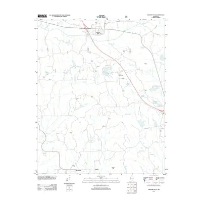
2012 Map of Hickory Flat
USGS Topo · Published 2012About this map
Hickory Flat anchors the northern portion of this landscape, where the local street grid including Locust St and Cedar St meets the bypass and the older route of Old Hwy 78. The terrain is defined by the Darden Hills in the south and an intricate network of waterways like Mill Creek and Floyd Creek. For local historians and genealogists, this 2012 survey identifies numerous family and community landmarks, such as Macedonia Cemetery near the settlement of Macedonia and the Myrtle Lookout Tower positioned on a ridge overlooking Lake Arrowhead. The map reveals a transition from the concentrated residential streets of the town to a rural expanse punctuated by small lakes such as Barnes Lake and Springdale Lakes, reflecting the persistent agricultural and timber character of the region.
Find a feature on this map
78 named features on this map. Tap any name to fly to it.
Don’t see what you’re looking for? This feature index may not catch every label — zoom into the map to look around manually.
Map Details
Editions of this 2012 Hickory Flat Map
This is the sole edition of this map. No revisions or reprints were ever made.
Other maps of this area

1942 · Denmark
USGS Topo · 1:62,500

1943 · Denmark
USGS Topo · 1:62,500

1944 · Potts Camp
USGS Topo · 1:62,500

1945 · Potts Camp
USGS Topo · 1:62,500

1949 · New Albany
USGS Topo · 1:62,500

1951 · New Albany
USGS Topo · 1:62,500

1955 · Blue Mountain
USGS Topo · 1:62,500

1956 · Tupelo
USGS Topo · 1:250,000

1958 · Tupelo
USGS Topo · 1:250,000

1980 · New Albany West
USGS Topo · 1:24,000