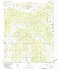
1982 Map of Hickory Flat
USGS Topo · Published 1983About this map
Hickory Flat serves as a primary rail hub in this northern Mississippi corridor, situated along the Burlington Northern line at the junction of three counties. The landscape is characterized by the transition from the rolling Darden Hills in the south to the structured timberlands of the Holly Springs National Forest which dominates the central portion of the sheet. Numerous small, rural communities and family-named landmarks are scattered throughout, including Oaklimeter, Cornersville, and Old Myrtle.
Find a feature on this map
50 named features on this map. Tap any name to fly to it.
Don’t see what you’re looking for? This feature index may not catch every label — zoom into the map to look around manually.
Map Details
Editions of this 1982 Hickory Flat Map
This is the sole edition of this map. No revisions or reprints were ever made.
Other maps of this area

1942 · Denmark
USGS Topo · 1:62,500

1943 · Denmark
USGS Topo · 1:62,500

1944 · Potts Camp
USGS Topo · 1:62,500

1945 · Potts Camp
USGS Topo · 1:62,500

1949 · New Albany
USGS Topo · 1:62,500

1951 · New Albany
USGS Topo · 1:62,500

1955 · Blue Mountain
USGS Topo · 1:62,500

1956 · Tupelo
USGS Topo · 1:250,000

1958 · Tupelo
USGS Topo · 1:250,000

1980 · New Albany West
USGS Topo · 1:24,000