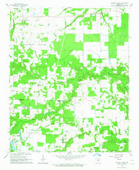
1964 Map of Hickory Plains
USGS Topo · Published 1965About this map
The community of Hickory Plains serves as the focal point for this mid-century survey of the Arkansas interior, situated along the upper reaches of Hickory Plains Creek. The landscape is defined by its drainage patterns, with numerous named waterways such as Lick Creek, Bane Creek, and Dunn Creek flowing into the prominent Wattensaw Bayou. These water sources supported a rural economy of small-scale agriculture and livestock, evidenced by the fine network of field and fence lines recorded across the township.
Find a feature on this map
32 named features on this map. Tap any name to fly to it.
Don’t see what you’re looking for? This feature index may not catch every label — zoom into the map to look around manually.
Map Details
Editions of this 1964 Hickory Plains Map
This is the sole edition of this map. No revisions or reprints were ever made.
Other maps of this area

1932 · Kensett
USGS Topo · 1:62,500

1935 · Kensett
USGS Topo · 1:62,500

1935 · Hazen
USGS Topo · 1:62,500

1940 · Lonoke
USGS Topo · 1:62,500

1941 · Hazen
USGS Topo · 1:62,500

1948 · Helena
USGS Topo · 1:250,000

1949 · Lonoke
USGS Topo · 1:62,500

1950 · Helena
USGS Topo · 1:250,000

1950 · Lonoke
USGS Topo · 1:62,500

1953 · Memphis
USGS Topo · 1:250,000